Data Simulation to Support Interdependence Modeling of a Multimodal Transportation Network
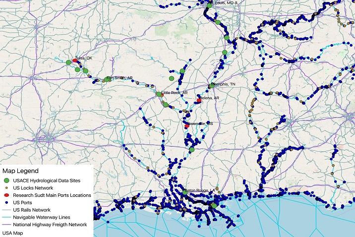
The inland waterways in the United States (U.S.) are used to transport approximately 20% of America’s coal, 22% of U.S. petroleum products, and 60% of farm exports making these waterways a significant contributor to the U.S. multimodal transportation system. In this study, data about natural extreme events affecting inland waterways are collected and used to predict possible occurrences of such events in the future using a spatio-temporal statistical model. We also investigate the waterways disruptions effect on interconnected transportation systems using a simulation tool built on a statistical model. The developed methods are centered on inland waterways but can be used broadly for other local, regional and national infrastructures. A case study based on the Mississippi River and the McClellan–Kerr Arkansas River Navigation System (MKARNS) is provided to illustrate the use of the simulation tool in interdependence modeling and decision making for the operation of a multimodal transportation network. Simulated data will be derived from actual data on interdependent critical infrastructures (ICIs). The ICIs related data includes:
- Inland waterway and ground transportation networks (e.g. road type and capacity of road network).
- Location of locks and dams.
- Location of major ports and their top commodities.
- Historical hydrological observation data at ports and locks including water depth, changes in waterways, and the normal capacity of inland water transport.
- Major types of cargo vessels and barges classified by their capacity and usual transport speed.
- Weather data covering the studied regions.
To use the simulation tool, please fill out the request form below in order to get the tool, its user manual and general instructions for it usage within 24 hours.